Teatime, Coffee Break
食は楽しみ。ーーどなたか教えてください。
Pleasure to eat... Could someone show? (Jul 26,2015)
Could someone show the restaurants that make the most of stock of rice
itself. Particularly in Kanto or Tohoku area, or Tokyo……..<Urgent disappointment
of a glutton who loves rice>Boiled rice is too soft to enjoy eating in almost of restaurant in the city. I found it maybe five years ago. In a magazine or TV program for cooking, though they show place of production or how to cook for fish or meat precisely, they do not say for the rice. In any restaurant, similarly, we can order well-done, medium for the meat, well-done or soft-boiled for the egg, however, we cannot order grade of boiling for rice. The word "staple food" is already obsolete and rice is served as an extra. I am anxious to ask a restaurant staff to serve just before burnt rice, rather hard, medium hard, and rice gruel to enjoy choosing, and to enjoy chewing well rice. Is there anyone think so?
For the bread, I would like a rather hard ones also. As long as I feel happiness to chew, salivate, taste and swallow.
どなたか、ごはんそのものを大切にするレストランを紹介してくれませんか。
<ごはんが大好きな者のなげき>
街中にあるレストランのごはんが軟らかすぎて食の楽しみが薄れています。ここ5年ぐらいの傾向だと思います。雑誌やテレビ番組では魚貝、肉等の料理となると産地、料理法等を丁寧に紹介してあるがごはんについては記載なし。肉ならwell-done, medium, rareという注文もできるのに、卵はwell-done、半熟、生という注文ができるのに、ごはんについては炊き加減(水加減)を注文することはできません。「主食」ということばがもはや死語となりごはんはついでに間に合わせという程度になってしまいました。ごはんも a焦げ直前、b固め、c中程度、dおかゆ、を用意して欲しい。そう思う人いませんか。パンも同じです。硬めのパンも楽しみたい。噛んで、唾液を出して、味わって、飲み込むことに幸福を感じるうちは。
ほっとする橋. Bridge to feel relieved. (Oct 16,2014)
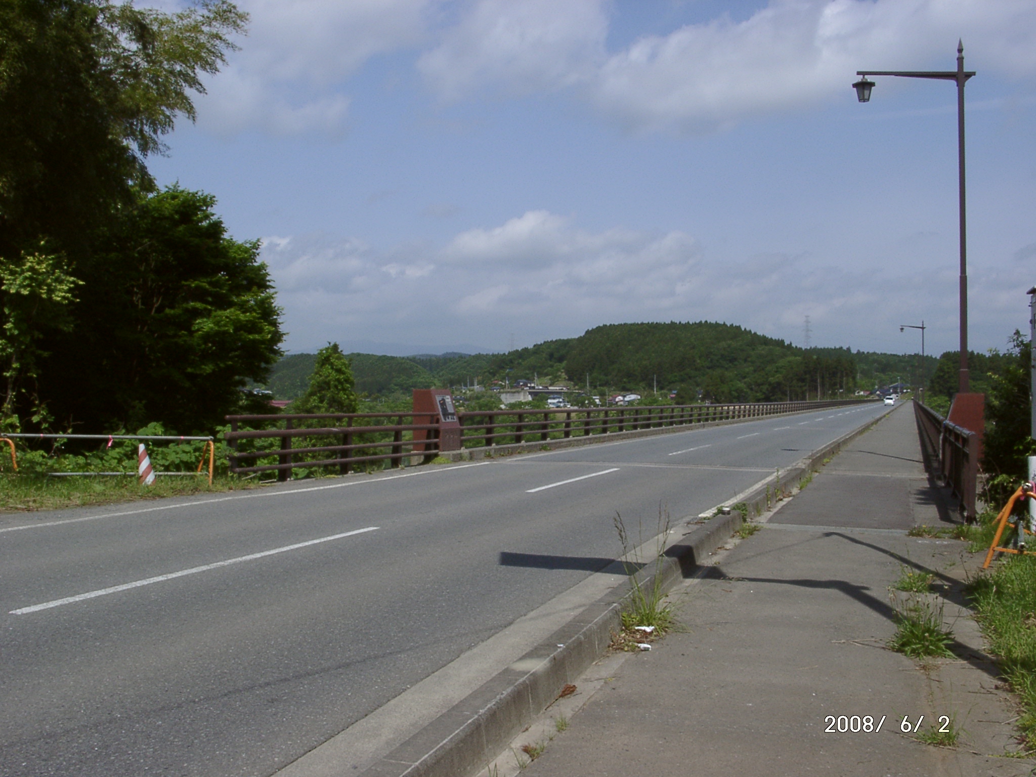

Bridge to feel relieved, at Sawaguchi Nagashima, Hiraizumi-chō, Nishiiwai-gun, Iwate-ken
It is 2 km to the east from the Hiraizumi-Maesawa Interchange of the
Tohoku Expressway, named “hakoishi-bashi”. Though it is not uncommon bridge
(upper left photo), if we see it closely, it would be (good for us to feel)
an emotional scene to make us imagine the era of the Oshu-Fujiwara clan,
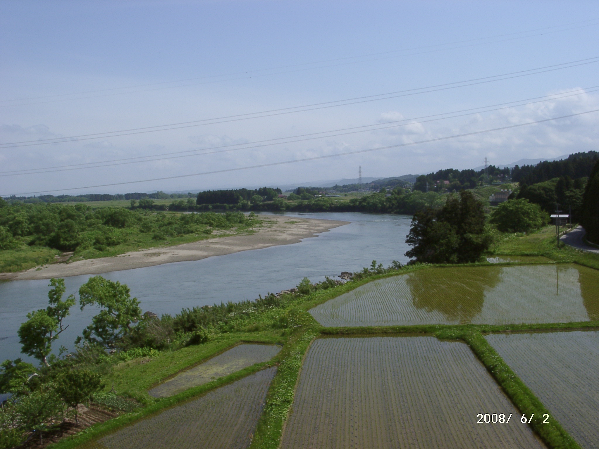
the culture of Hiraizumi. The right photo shows line of young rice plants
just set, green grid formed walkways between rice fields and then the Kitakami
Liver streaming slowly without foam under the bridge.
Then、if we look at it from a little different angle, we are able to find
a time axis that, along the curved riverside shaped by the river, successive
people have made paddy fields, developed farming technics to harvest rice,
applied engineering to construct a bridge, and have, finally, described
a name of the bridge with a sense of history and art. When we pass along
this bridge, we will appreciate a set of such history of wisdom in time
axis and the scenery, i.e., space axis, of river and riverside we can view
from near to far combined with blue sky visible in the distance. This is
a bridge makes us feel relieved because of being busy.
→map
○An elegant poetry contest @Hiraizumi
→Gokusui no En
岩手県西磐井郡平泉町にある、ほっとする橋。
東北自動車道の平泉前沢インターから237号線を東に約2km にある橋、名前は「箱石橋」。遠くから見れば珍しくもない橋ですが、近づいてよく見ると平安時代末期の100年間(800-900年前)に開花していた奥州藤原時代(平泉文化)の一部を感じさせてくれるような情緒のある風景となります(なるといいのだがなあ)。
写真は橋の下に広がる、田植えを終えたばかりの整然と並んだ苗列と、緑色をしたマス目上のあぜ道です。その背後は白波を立てずにゆったりと流れる北上川です。
そこでよくみると、川が作った曲線形状の岸辺に合わせて歴代の人々は水田をつくり、農業技術で米を栽培し、工学で橋を架け、最後に歴史感と絵心で橋の名称を表示したという時間軸が見えてきます。この橋を通る人はその時間軸上にある人々の英知の歴史と、遠くまで見える川と川岸、その向こうにある青空からなる背景を組み合わせた景観(空間軸)を味わうことになります。忙しい時代にあってもほっとする橋です。
風景に生える成りゆき草. Free Landscape (Aug 16, 2014)
This monologue will be some matters relating to a river “Kitakami River”
which flows from Iwate prefecture to Miyagi prefecture through 250 km.
By the way, my hometown, Shizuoka city, does not have such a long river.
People live in Shizuoka maybe understand the scale of 250 km if imagine
a geographical scale between Shizuoka and Tokyo to be 180 km. The distance
between Shizuoka and Nagoya is also 180 km, just in case.
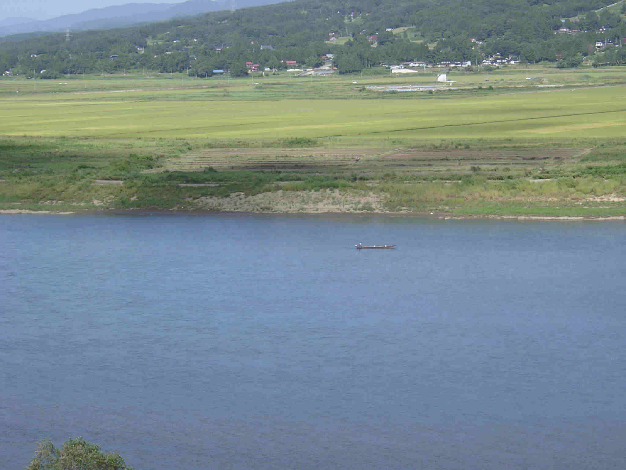
Photos here show the views at Hiraizumi town located in the midstream
of Kitakami river. Its width is approximatly100 to 200 m. You see a boat
on the river. Maybe it is considered to reflect prospering transportation
by water until construction of a railway of 1880s, Tohoku Line,
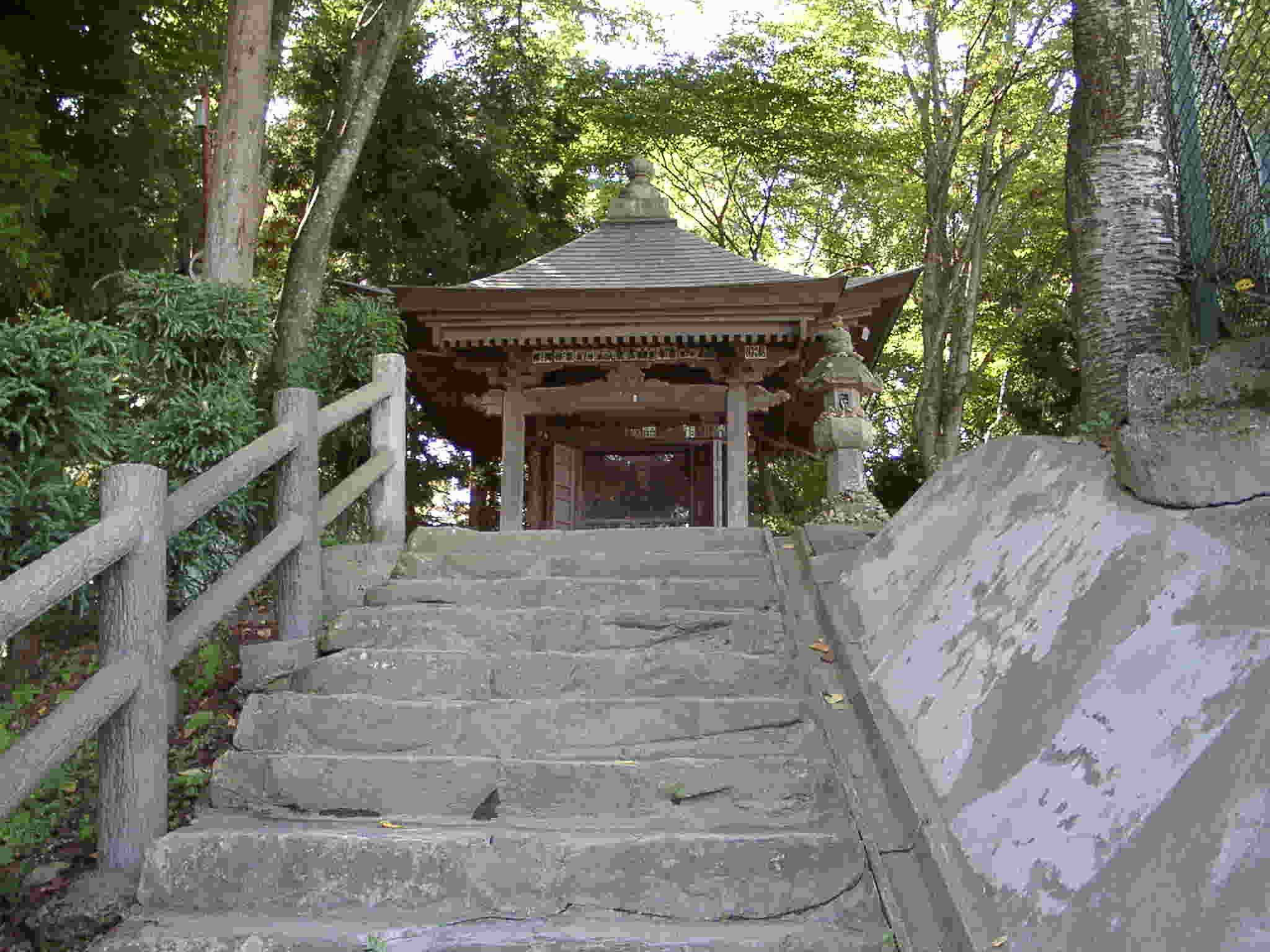
There is a small hall “Gikeidou” in HIraizumi.town. In 1189, Minamoto
no Yoshitsune was killed by FUJIWARA no Yasuhira of the Oshu-Fujiwara clan.
In 1683, five hundred years later from that, President of the Sendai domain
built it in order to think of Yoshitsune.
http://www.motsuji.or.jp/gikeido/about/index.html
Soon after this, May 1689, a Japanese haiku poet Matsuo Bashō visited
here to describe prosperity covering three periods of Fujiwara clan and
its fall. Now we are 330 years later from the building by the Date clan
(Sendai Domain). I will expect someone lives in 2500's will think of a
person lives in 2000's. It is a consideration in the time axis for long
range.
→map
→地図
岩手県から宮城県に向かって流れる全長250 kmをもつ北上川に関連させた景色を気のむくまま紹介します。出身地静岡県にはこのような長い川はないので静岡―東京の180
kmより長いという表現を使うとイメージがつかめます。さて、写真はこの北上川の中流にある平泉町から見た風景です。川幅ほぼ100~200 m。船が見えます。かつて東北本線ができるまで舟運、水運が栄えていたことの証でしょう。
この町に義経堂(ぎけいどう)があります。1189年に源義経は泰衡軍の攻撃に討たれました。その後500年の月日を経た1683年に仙台藩主が義経を偲んで建てたとのことです。その後まもなく芭蕉がこの地を訪れ、藤原氏三代の栄華を「三代の栄耀一睡のうちにして・・」と表現しました(1689年)。その約330年後に私たちはいます。では2500年代の誰かが今の2000年代の誰かを偲んでくれるといいな、などと考えると時間軸の長い話です。
△▼△▼高校生の時、小倉勇三先生の古典の授業で、数回は奥の細道がテーマでした。脳裏に焼き付いたその時の印象をもって初めて平泉を訪れたとき800年を旅したような気がしました(嘘もほどほどに)。2003年タッキーとマツケンの大河ドラマ義経は全部見ました。
ー
()
●●●●
()
information
(株)健康データハウス
・代表取締役
大川井宏明
・
.
.